Adding raster data to QGIS
Introduction
Some data, such as the digital versions of the Landranger and Explorer maps, are provided as raster data files and do not contain feature geometries. Raster data can also include DTM and DEM data, as well as “pictures” like the 1:50,000 scale raster data.
Preparation
Adding TIF images
When you download any data in .tif format, you will notice it is includes a .tfw file of the same name. Ensure that both the .tif. and .tfw files both have the same name and are stored in the same folder. If you are using multi-band tiffs such as the Land Cover Maps from Environment Digimap you may need to adjust the layer styling.
Set the Coordinate Reference System
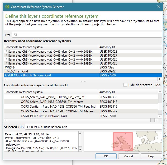
It helps to set the Coordinate Reference System for the QGIS project before importing any data. To do this, click the Current CRS button in the bottom right hand corner.

This brings up a dialogue box:

Select OSGB 1936 EPSG: 27700 from the options and click Apply.
NB: if you have trouble retaining the correct projection when you add your data, check the default Project settings. Go to Settings » CRS » check the “Prompt for CRS” option and click “OK”.
Now add your data:
-
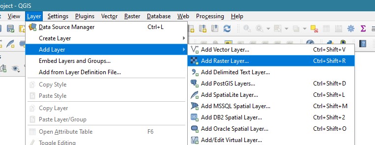
Open QGIS and go to the menu: Layer > Add Layer > Add raster layer. This opens a new dialogue box

-
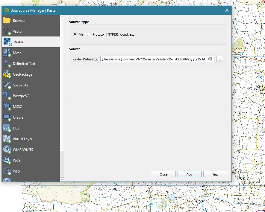
Click the three dots … at the end of the “Source” field. Navigate to your data and select the .tif files. Use Shift+click to select multiple files. Click “Open”.

-
On the next screen click “Add”. Note that the data files load in the background but you may see a temporary warning about the CRS (Coordinate Reference System) flash up at the top of the screen if you have not already set the CRS. Next click “Close”:

-
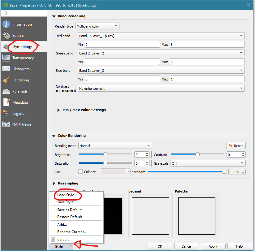
Some of the data delivered from Digimap includes a .qml file in the Docs folder. You can use this to apply styling to your raster data. Right click on the layer in the left hand panel and select Properties. This brings up a dialogue box.

Select Symbology, on the left. Then click the Style button (bottom left) and choose Load Style. Navigate to your .qml file. Click Open and then click Apply.
Adding ASC files
Follow the process above but select your .asc files instead of the .tif files. You will need to adjust the symbology settings according to your desired display output.