Get Feature Information Tool
Get feature information tool
This tool is found on the top toolbar and is used to find information on maps and/or features in the map window. Note the tool is not available in all collections.

Using the tool
- Select the tool from the top toolbar.
- Select the feature of interest on the map window.
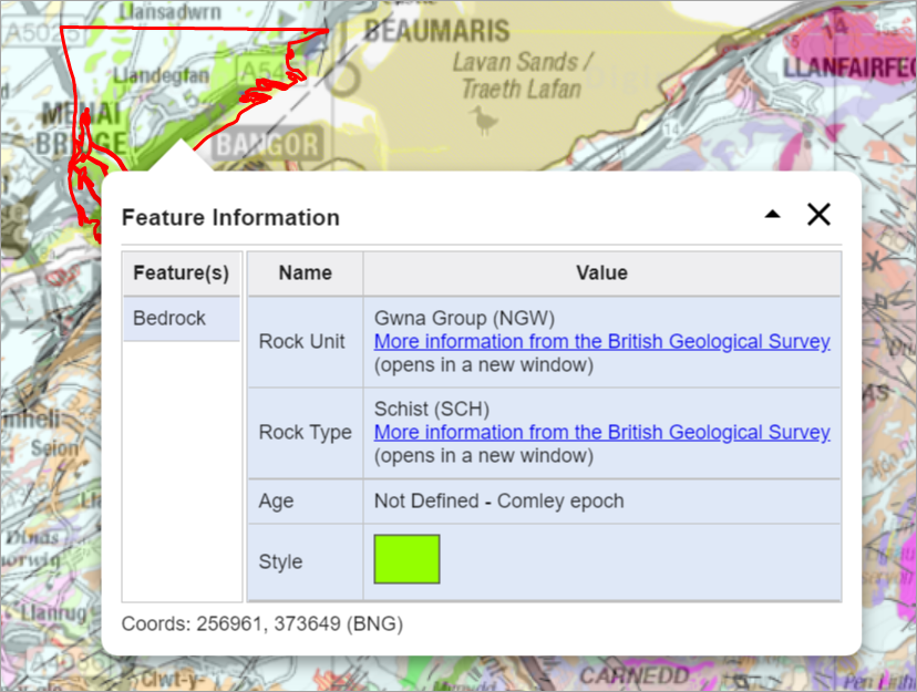
- A box pops up on the map window with feature information. The example image below is from Geology Digimap.

What information is provided?
Ordnance Survey Digimap
The feature information tool is active only for certain overlays:
- Points of Interest (POI) overlay - find category, postcode and other details for any point in the POI dataset.
- Contours and spot heights overlay - find height information and British National Grid reference for contours or spot heights.
Historic Digimap
Historical map details, including the product name, scale, and year of publication.
Geology Digimap
Details from the British Geological Survey’s Lexicon of Named Rock Units, such as rock unit, rock type and age.
Marine Digimap
Details from the Marine Themes vector data on the selected features. For example: depth features, shipwrecks or navigation lines.
Chart Digimap
Chart number, title and scale.
Environment Digimap
The name and date of the map, e.g. Land Cover Map 2015, plus the feature class e.g. improved grassland.
Aerial Digimap
Date the aerial image was captured, plus the National Grid tile name.
Verisk Digimap
The tool is active on most Verisk maps. Find inforamtion on land use, building age and building use.
Global Digimap
The tool is only active with one overlay:
- WWF World Biomes - select any biome area to discover its name, eco name, region and other details.